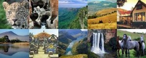
Mpumalanga – “the place where the sun rises” – is a province with spectacular scenic beauty and an abundance of wildlife, lying in the northeast of South Africa.
Bordered by the countries of Mozambique and Swaziland to the east and the Gauteng to the west, it is situated mainly on the high plateau grasslands of the Middleveld, which roll eastwards for hundreds of kilometres. In the northeast, it rises towards mountain peaks and terminates in an immense escarpment. In places this escarpment plunges hundreds of metres down to the low-lying area known as the Lowveld.
In the eastern region lies the southern half of the magnificent Kruger National Park, a nature reserve teeming with African wildlife in a total area roughly the size of Israel.
Mpumalanga is highly accessible, with a network of excellent roads and railway connections, as well as a number of small airports, including the Kruger Mpumalanga International Airport.
Mbombela (previously Nelspruit) is the capital, and the administrative and business hub of the Lowveld.
eMalahleni (previously Witbank) is the centre of the local coal-mining industry; Standerton, in the south, is known for its large dairy industry; and Piet Retief in the southeast is a production area for tropical fruit and sugar.
A large sugar industry is also found at Malelane in the east; Ermelo is the district in South Africa that produces the most wool; Barberton is one of the oldest gold-mining towns in South Africa; and Sabie is situated in the forestry heartland of the country.
The Maputo Development Corridor links the province with Gauteng and the Port of Maputo in Mozambique, acting to release the economic potential of the landlocked parts of the country.

